Hi folks. This seems to be a slightly rarer contravention, and in this particular case I am genuinely not clear how it applies (so I assume I'm missing something).
The location the vehicle was parked is a driveway, between two pavements, next to a Shell garage.
In fact the driveway appears to be (per Street View, link below) the usual exit from the Shell garage, but on this occasion that exit was blocked off by plastic barriers which you can partially see in the photographs (also linked below).
PCN date: 23/1/2026
Contravention date: 21/1/2026 at 13:57
Contravention location: O/S 33-35 HANGER LANE W5
Google maps link to location:
Find local businesses, view maps and get driving directions in Google Maps.
Google street view of the location:
Find local businesses, view maps and get driving directions in Google Maps.
Photos:
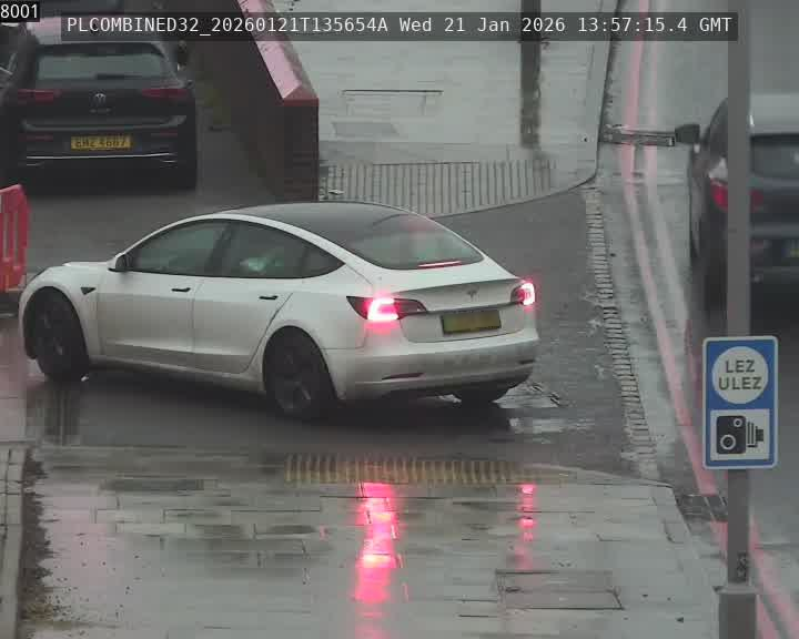
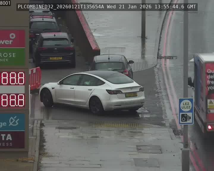
I guess potentially that area between the two bits of pavement is still considered 'footpath' or 'any part of a road other than a carriageway'? Or maybe there's something I am missing in the photos. Any help appreciated, in any case.
Thanks and let me know if there's any other information I can provide.
